Streams of Seoul - The Beginning
Thank you, unknown returning reader, for stopping by my blog. I genuinely hope that my brilliant wit and fantastic writing skills are driving you back for more. (pssst… I would like to know you more, so come to my twitter) To all of you amazing people, welcome to this corner of the internet, and I hope you will enjoy this adventure we’re about to go on. We are about to discover waters long forgotten, waters once vital to the development of the fantastic city of Seoul!
Today’s topic #
Today we will take a look at a favourite area of mine, the beautiful Gwanghwamun and Sejong village, a.k.a. Seochon! If you have been to Cheonggyecheon, some of you might have wondered, “Where is this water coming from? Is it pumped from somewhere? This stream makes no sense”.
Background #
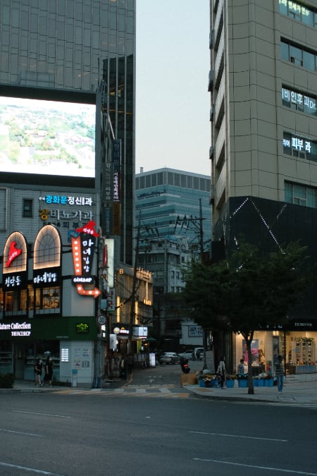
From time to time I have these I have these moments where something random catches my attention from time to time, and I just have to research it for the itch to stop. This is how this topic came to life. While waiting for a green light, I took a photo of this very small street Semunan-ro right next to exit 7 of Gwanghwamun station, and I thought to myself… “What? Why?” So I went on a google search adventure, and this is how this chain of tweets came to life.
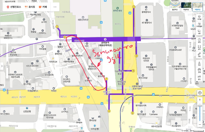
There is this road between exit 7 and 8 of Gwanghwamun station and it’s a weird one.
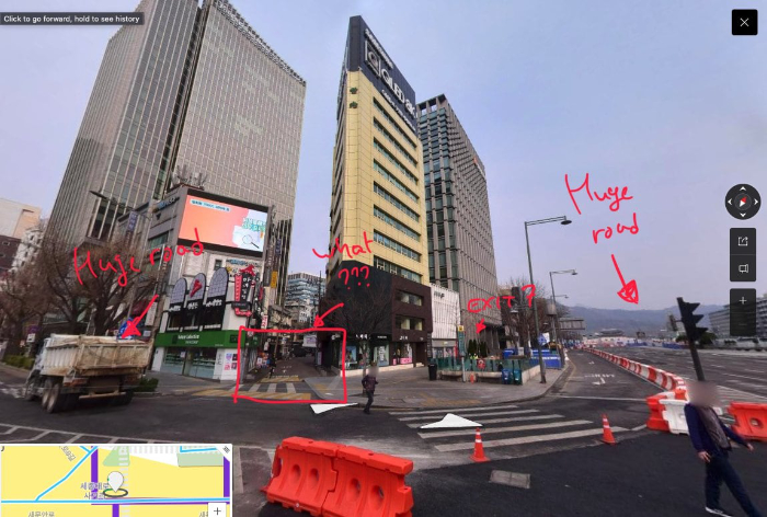
The land is divided in a very intriguing fashion.
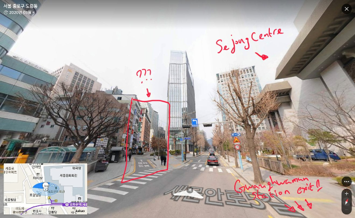
This is taken right in front of exit 1 of Gwanghwamun station. You can see the road just goes north and cuts everything in triangles along the way.
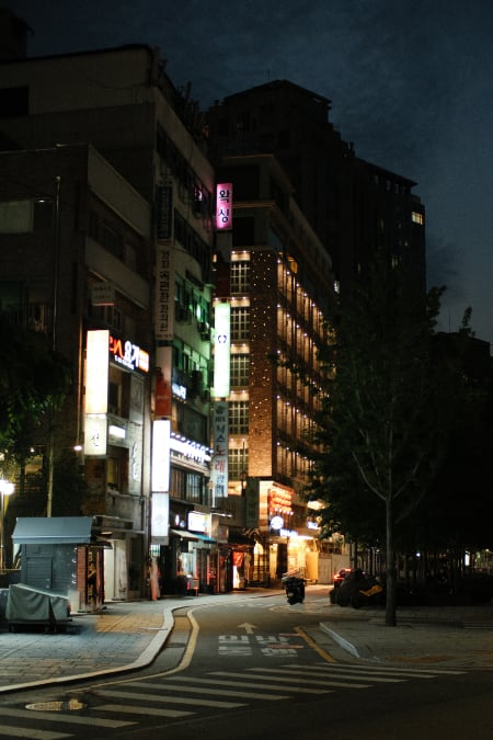
Semunanro now #
 |  |
Cheonggyecheon (청계천) #
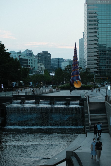 | 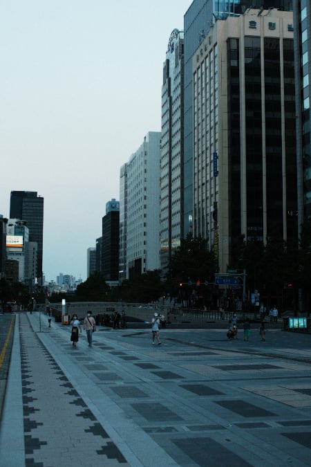 |
Most people who have visited Gwanghwamun and the entrance to the Cheongyecheon stream could think that this is where it starts its journey to the east to its destination, the Jungrang and Han river.
A long time ago in a land a few kilometres away from me (around 10ish km for those of you not curious), Gyeongbokgung Palace was surrounded by two streams flowing south. These streams eventually meet to become a part of a bigger stream called Cheonggyecheon and today we will take a look at two of these streams.
Cheonggyecheon was originally called Gaecheon (개천 / 開川). Records show the use of the current name to be sometime after the Japanese occupation of Korea (Link to article)and a possible origin of the name is the small valley on the east side of Inwang mountain called Cheongpunggye (청풍계/淸風溪) which in turn means “clear windy stream”.
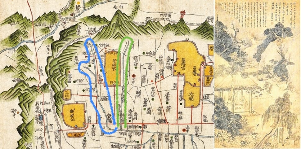
The reason for the very strange layout of the square (Semunan-ro 9gil and 5gil) is that the streets house Baekundongcheon (백운동천), the stream the flows to the west of the palace. I already introduced the stream to the west called Baekundongcheon (백운동천) and let me introduce the stream to the east called Junghakcheon (중학천).
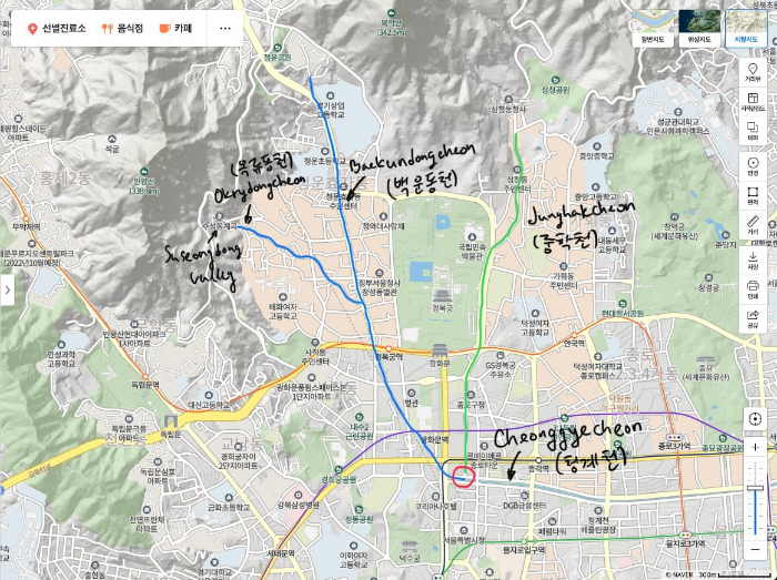
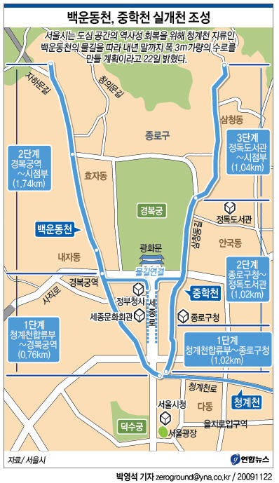
This is where the 2 streams surrounding Gyeongbokgung Palace currently are.
Baekundongcheon (백운동천) #
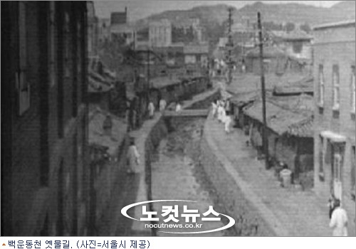
Here is a photo of how Baekundongcheon looked like a long time ago.
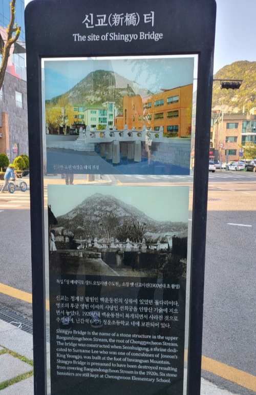
One place you can find evidence of the stream is on the other side of the Cheongunhyojadong Citizen Centre (청운효자동 주민센터). The plaque there commemorates the Shin bridge that linked the palace with the Suseongdong valley (수성동 계곡/水聲洞 溪谷) which apparently was a famous retreat for the high-society of Hanyang.
Junghakcheon (중학천) #
When we go to the east of the palace we have the location where Junghak stream used to flow before it was covered in asphalt.
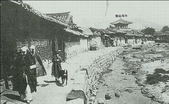
A historical photo of the Junghakcheon stream. The tower in the distance is the Dongshipjagak which still stands tall today and can be seen on the southeast corner of the Gyeongbokgung Palace in the middle of a large intersection.
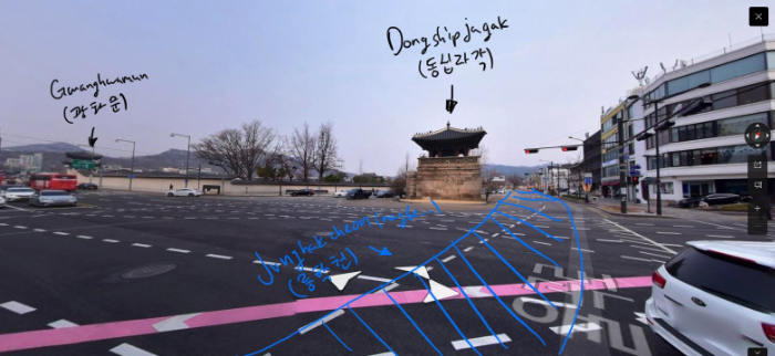
The tower was the south-east corner of the palace built right next to the stream so we can predict where the stream used to flow.
Beautiful plans that will never see the light of day… #
Around 2009 there were plans to restore both streams and connect them with Cheonggyecheon (article in Korean) but as you can see they never come to be, which is a bit sad because the city needs more pedestrian-friendly retreats and Cheonggyecheon is a great example of a successful reconstruction of an old stream. I personally run down the stream from time to time and it is packed with people just up and about having a chill time with the clear water. If the two streams are restored one day I have a feeling the area will transform into this pedestrian-friendly paradise full of history. Let’s hope one day this dream comes to life, but until then we are only left with the dream.
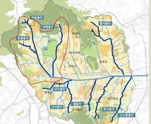
Next time I will try to find where the streams on this image are and how have they affected the city. When I have enough time I have a plan to explore I will be more than glad to take you on a photo adventure with me!
P.S. #
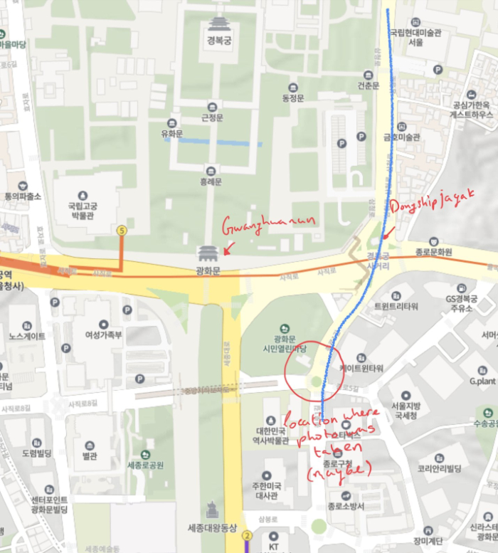
The approximate location of where the old photo of Dongshipjagak was taken. I tried taking a photo from the same location but the tower is just not visible.